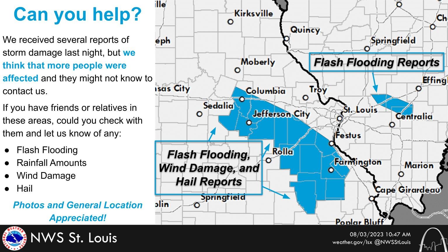
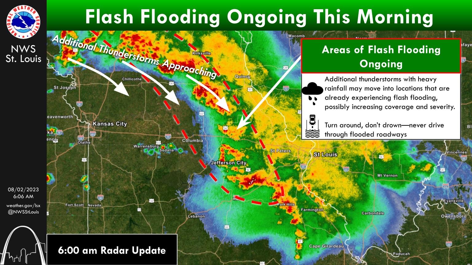
Missouri Governor Mike Parson (R) signed an approximately $51-billion state operating budget this summer. He also issued 201 line-item vetoes totaling about $555-million, including many projects in GOP legislative districts. State Rep. Dave Griffith (R-Jefferson City), who chairs the Missouri House Veterans Committee, joined us live on 939 the Eagle’s “Wake Up Mid-Missouri” Friday and tells listeners that the 111 Missouri House Republicans will hold their summer caucus this month in Branson, where they will discuss September’s veto session. Representative Griffith also discussed the flooding in Callaway County, which has closed busy Highway 94. He wants to see the state be more proactive on highways like 94. Chairman Griffith also expresses disappointment that the GOP-controlled Missouri Legislature failed to pass a veteran suicide bill in 2023:
UPDATE: National Weather Service requesting storm damage reports from mid-Missouri
The National Weather Service (NWS) in St. Louis has received reports of wind and hail damage from the storms overnight and this morning in mid-Missouri.
The NWS says damage is reported in Boone, Cole, Callaway and a number of counties in the 939 the Eagle listening area. Damage is reported in the Columbia and Jefferson City areas and small towns near Jefferson City. The NWS is asking you for photos of any damage, along with rainfall amounts.
NWS St. Louis meteorologist Jayson Gosselin tells 939 the Eagle that Columbia Regional Airport (COU) has received 3.74 inches of rain since midnight. New Bloomfield has received about six inches of rain.
The NWS St. Louis office is located in Weldon Spring. Their main phone number is (636) 441-8467.
(LISTEN): Boone, Randolph and Howard counties under flood warnings
Boone County remains under a flood warning until 7:55 on Wednesday morning, while the flood warning for mid-Missouri’s Randolph and Howard counties goes until 12:37 pm.
The National Weather Service (NWS) says Columbia, Jefferson City and Mexico could see up to five inches of rain from the overnight thunderstorms that continue to move through mid-Missouri. NWS St. Louis meteorologist Melissa Byrd also says a flood watch covers the entire 939 the Eagle listening area:
“Be careful when out driving, watch for flooded roadways. Remember it only takes about six inches to knock a person off their feet in floodwaters and maybe a foot or so of flowing water can lift your vehicle and move you off the road,” Byrd tells 939 the Eagle.
The NWS says thunderstorms producing heavy rainfall started at about 11 Tuesday night. Flash flooding is the primary hazard from these storms. NWS St. Louis meteorologist Marshall Pfahler tells 939 the Eagle that radar estimates show that three to five inches of rain have fallen in parts of Boone counties, in the flood warning area.
Keep your radio tuned to 939 the Eagle for updated weather information.
Dangerous heat continues in Columbia; mid-Missouri could see some Saturday storms
Widespread dangerous heat continues this morning across mid-Missouri.
The National Weather Service (NWS) in St. Louis says temperatures will be around 100 again today in Columbia and Jefferson City, with heat index levels around 108. They’re urging you to drink plenty of water and to wear light-colored clothing.
The NWS also says there’s a chance of severe thunderstorms Saturday in Columbia, Jefferson City and Fulton. NWS St. Louis meteorologist Brad Charboneau tells 939 the Eagle that the best chance of any severe storms is Saturday afternoon and evening, if we see anything. He says gusty winds and hail would be the main threat.
Keep your radio tuned to 939 the Eagle for updated forecasts and weather information.
Mid-Missouri could see hail and damaging winds today
Columbia, Jefferson City, Ashland and Fulton could see some strong to severe storms late Monday morning and early afternoon.
The National Weather Service (NWS) in St. Louis says today’s main threats will be large hail and damaging winds, with storms entering Columbia and Jefferson City and moving to the southeast. NWS St. Louis meteorologist Melissa Byrd tells 939 the Eagle that the storms will begin in Columbia at about 11 this morning. Byrd says there is no tornado threat today.
The National Weather Service (NWS) reminds mid-Missourians to have a way to get weather updates, if you’re going to be outside today. Keep your radio tuned to 939 the Eagle for updated forecasts and weather information.
- « Previous Page
- 1
- …
- 10
- 11
- 12
- 13
- 14
- …
- 38
- Next Page »